By the end of this lab, students should be able to:
- Apply recognition elements to Land Use Land Cover (LULC) classification
- Identify various features using aerial photography
- Construct a land use / land cover map
This lab involved identifying features from aerial photography and classifying features into land use classes. The study area is Pascagoula, Mississippi. To classify features, I added a polygon shapefile to ArcMap, which was layed over a TIF true color image of Pascagoula. Using an edit session, I was able to make many polygons of features and then classify those polygons. The polygons were color-coded corresponding to class, and transparency was made so that features could still be seen. These polygons were classified by LULC codes and code descriptions. Polygons were made at a large scale at first (such as classifying the bay, wetlands, and residential areas), but got a little more detailed further into the process (such as classifying commercial, industrial, lakes, etc.). Classifications were made at least to level 2, sometimes level 3.
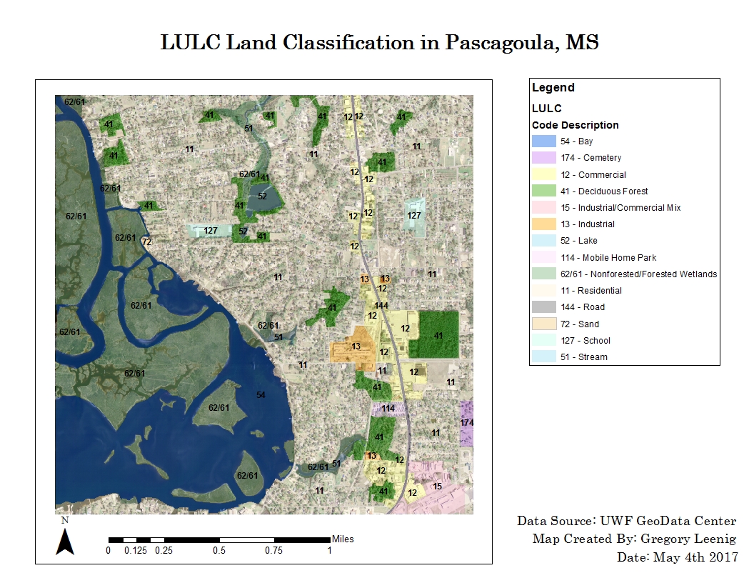
The map above classifies various land features in the study area. The numbers in the legend are the LULC codes.
No comments:
Post a Comment