Lab Objectives:
- Interpret tone and texture of aerial photographs
- Identify land features in an aerial photograph based on several visual attributes
- Compare similar land features in true color and false color IR photographs
This lab focused on visual interpretation of aerial photography, such as tone and texture gradients, identifying land features, and comparing land features in true color and false color infrared photographs.
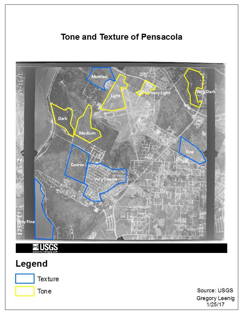
In the first exercise I identified areas based on tone, ranging from very dark to very light. I also identified areas based on texture (or roughness), ranging from very coarse to very fine.
In the second exercise, I identified land features based on patterns, shadows, shape and size, and associations.
For the third exercise I compared two photographs (one true color and one false color infrared) of the North Pensacola area. I compared land features, such as trees, rivers, buildings, marsh, and observed color differences in these features between the photographs.
I found it a little difficult to classify tone and texture, because sometimes there were subtle differences between the classes. However, I found it interesting that there are specific ways to identify and classify features in aerial photographs. Also, comparing photographs and features based on true color and false color is a new and interesting area of GIS for me.